After scoffing some chocolate croissants (the most suitable of all breakfast foods for an impending exertion of effort) I set off on the mountain bike. My goal was firmly set in my mind, despite the sat-nav saying it was going to be a 29 mile round trip…. I wasn’t committing myself to the whole loop, just one peak and the subsequent descent that looked to be good (read: steep)
I’ve got a new sat-nav app that David introduced to me. Its called OsmAnd+ which is an exceptionally catchy name, for an exceptionally good app… It’s fully offline, meaning you need to pre-download all the map data you want to see, but that means you don’t need any cell signal, like almost every other app on my phone. This is important because there are vast areas of Scotland that have zero cell service where its useful to have a GPS map.
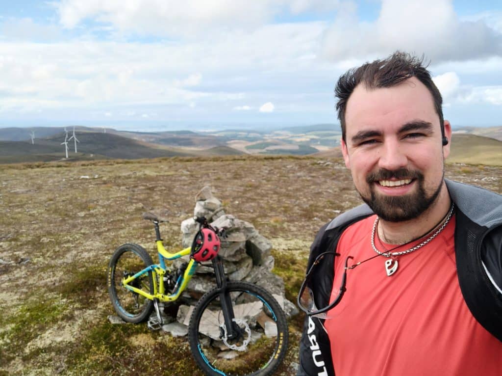
It’s also got some interesting and, what would have been, useful features if I had paid attention to them. Such as, the elevation graph it produces for a given route. Had I looked at this before setting off, I may have decided on a different ride as I was committing myself to a 15Km uphill cycle to the top of Meall an Tuirc (625m above sea level). The forest roads turned into wind turbine access roads and were very gradual in their gradient. Presumably so the delivery trucks could get to the sites for the installation of the turbines. This was great for me, because it wasn’t a hard climb, but it was LONG.
Finally I got to the highest point on the track and had to shoulder my bike to reach the very summit. This whole top portion of the mountain was barren apart from rocks and heather, which is not very interesting, but gave an interrupted panoramic view of the other rocks and heather around me. Obligatory selfie taken with the cairn, I set off down the hill and found the descent track. It was clearly less well used than the turbine tracks, I suspect it had been here for years before these humming wind cutters were installed. It just went straight down the side of the mountain, zigzagging in places but consistently steeply down and rocky.
I bounced down at a good speed but not too fast, conscious in the back of my mind that a fall would mean a very boring walk home, if I could walk at all. After a short way, which was probably half the elevation I had achieved, it split and entered a forest. This took a long and slightly less steep course along the side of the mountain. It was clear and a good track but grass and moss had started to cover everything and water had made channels and cuttings in the earth. Most of the loose soil was gone from the track leaving just rocks covered in slippery moss or grass. It was like skating on a lumpy ice-rink in trainers going down that path, barely holding a course, but really good fun!
It soon opened up to an area that was being logged and a lone stag bolted across my path. To it, I must have looked like a noisy alien clattering and grunting down the mountain all bright colours and pointy metal bits. I guess I was lucky that it was scared rather than angry at my appearance, becasue I’ve no idea what would have happened if it confronted me!
I made it out the bottom and found huge stacks of logs waiting to be loaded onto a truck that had just pulled in. I’d completed the objective I set out to do and now looked at OsmAnd+ for a route home that would be direct, but interesting. This track had worked out perfectly so I had no compunctions about trusting it fully again and setting off to find another forest track it had marked. I found it and after descending an annoying distance, it ran out, meaning I had to climb back up to the road. I had hoped that i would avoid any more climbing today…
This was when I noticed that my crank was not looking healthy. At least it had made it down the long descent, but I think if I had gone on any longer it may have come apart. Not something I wanted to happen at speed. Hitting it a few times with a big rock seemed to provide the required result this precision piece of engineering required, so I carried on.
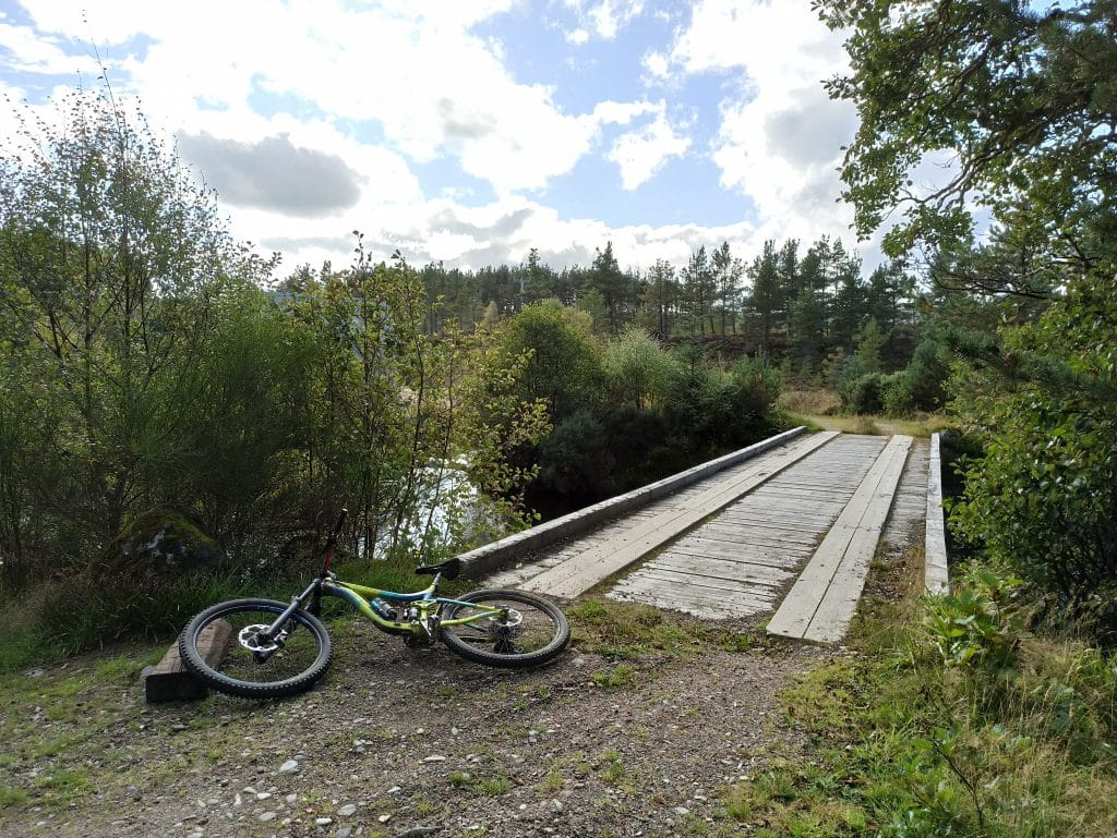
After a bit of road coasting, I took off down another marked path, one that looked a little more travelled this time. It lead to a metal bridge across an incredible surprise – a ridiculously deep gorge cut into the land. I had only just been following the river and it look more or less river-like in all ways. Yet this gorge turned up out of no where. I was lucky that the track had lead to the bridge, because there were others that must have lead to the gorges edge. Not something I would want to approach at speed on a mountain bike.
The gorge was a the top of the Evanton Community Forrest and had an info sign saying it was greated during the last Ice Age. The melting water had rushed off the mountains and cut this deep groove into the earth, exploiting a natural fissure. It was no more than 5m wide but it was at least 40m deep in places. The trees all masked the edge and the walls were covered in damp moss. It looked like a human venus fly trap. There was no whay you were getting out if you slipped in there and the water at the bottom looked like it was at 100 degrees C the amount it was boiling and gushing about.
Finally back home, the whole trip had been 35km’s, my longest yet. I was muddy and wet and exhausted but it was definitely worth the effort. Aimi had spent the day lounging around and taking it easy – its a holiday after all – so I did some of that too. Beer in hand we sat in the sun and enjoyed it before it dipped below the trees.
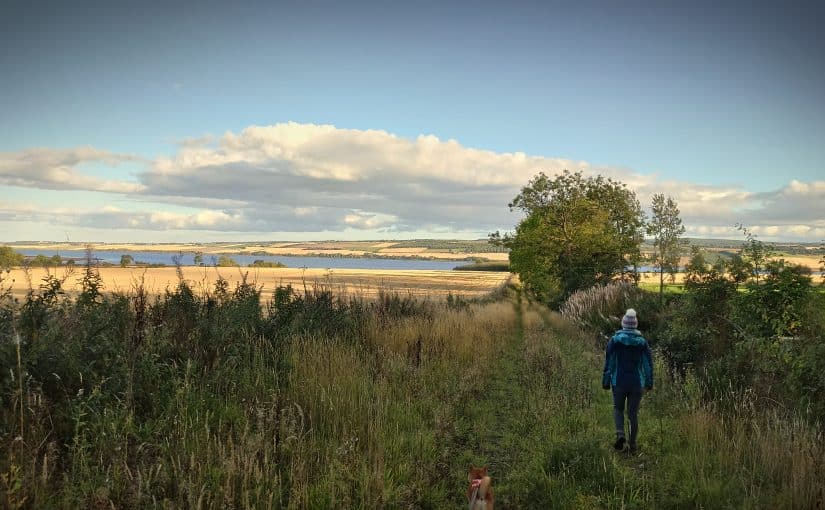
Becasue Aimi had taken it easy, she wanted to go for a walk down to the beach. It was only a 20 min walk and it was a beautiful evening so why not? Well it turned out to be much more than 20 mins, but we did see some seals basking on a rock. We definately need a telephoto lens for the camera, it was so cool to see them, but so frustrating that I could only get crappy, grainy and out of focus pictures.
Thoroughly exhausted now, we came home and without shame or remorse, ate an entire victoria sponge cake between us.
